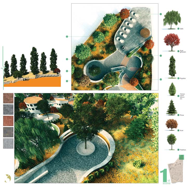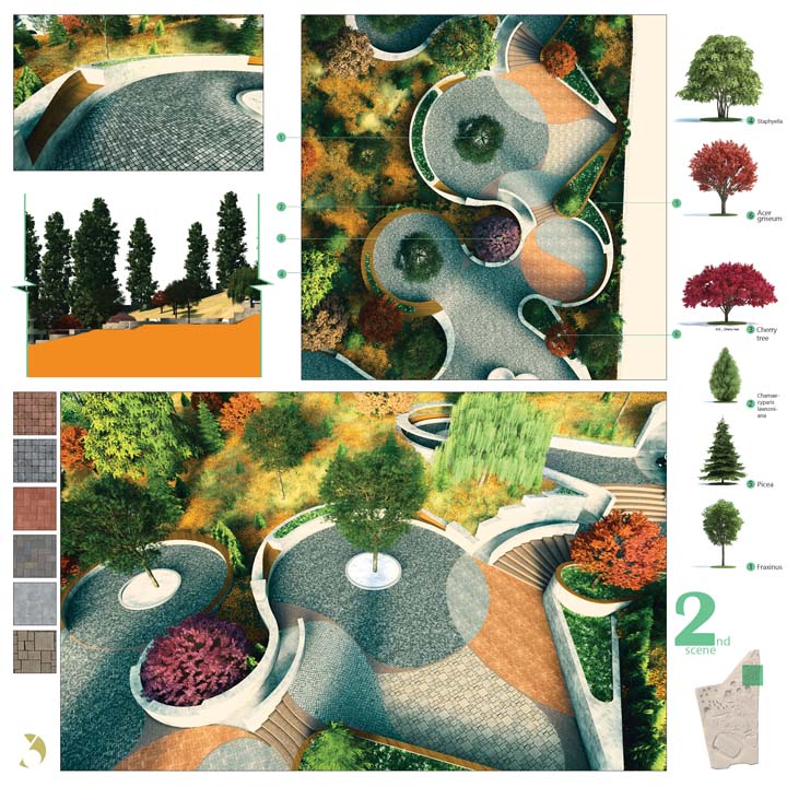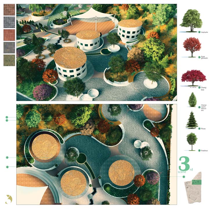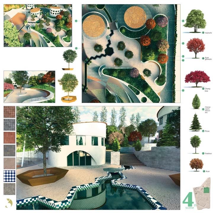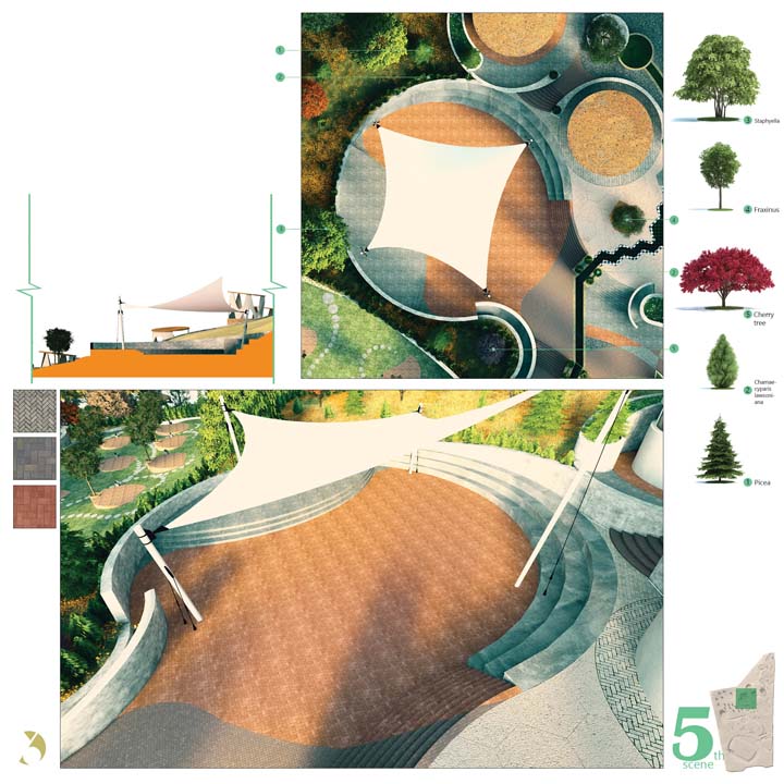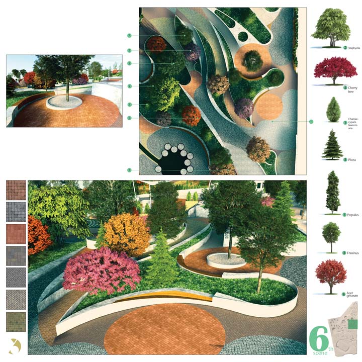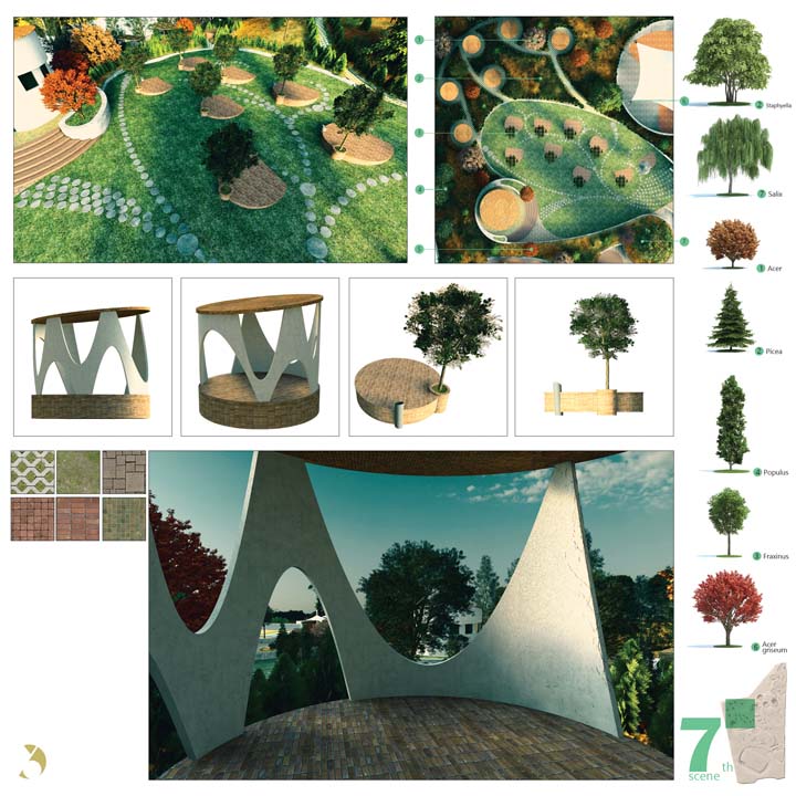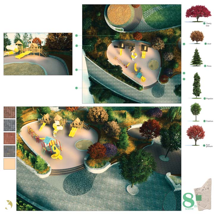
SKYWALKER PARK
In Landscape Design I during my master’s studies, I designed a four-hectare urban park adjacent to a highway in Saadat Abad, Tehran. The project became a formative experience that allowed me to develop a practical understanding of topography and its role in shaping spatial organization.
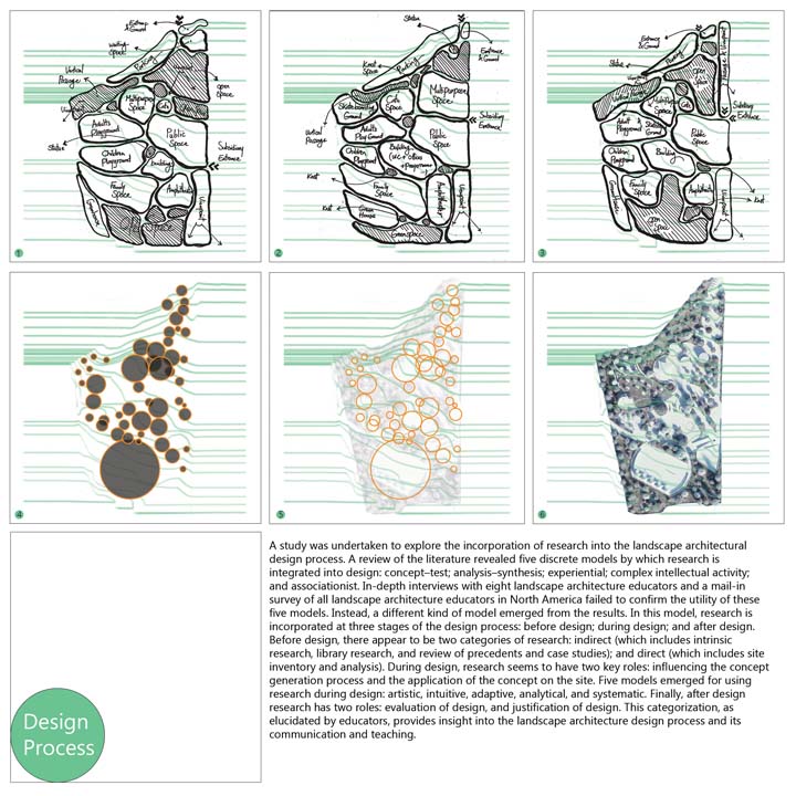
Design Process
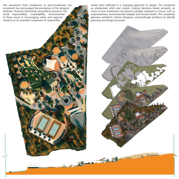
At the beginning of the studio, each student defined a set of everyday activities to be placed within the site. Because of the strong level changes, we explored where each activity could best fit in relation to the slope, and then developed a network of paths connecting them. As we tried to locate the program elements more precisely, it became clear that understanding the site’s topography was essential. This led us to study the terrain more carefully and identify flatter areas that could support the proposed uses. The design started in AutoCAD with the base drawings and was later developed in 3ds Max for 3D modeling. The final result is an integrated landscape model including terrain, vegetation, planting design, gravel areas, and paving systems.
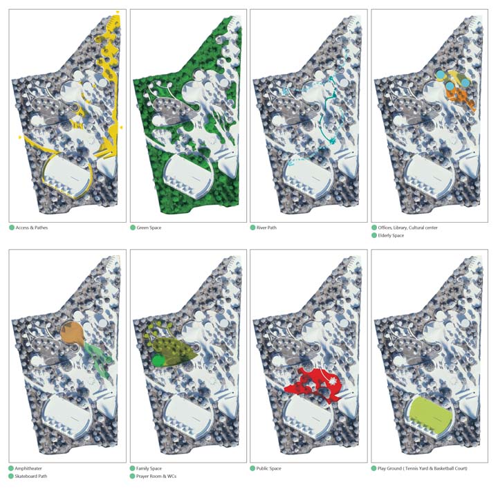
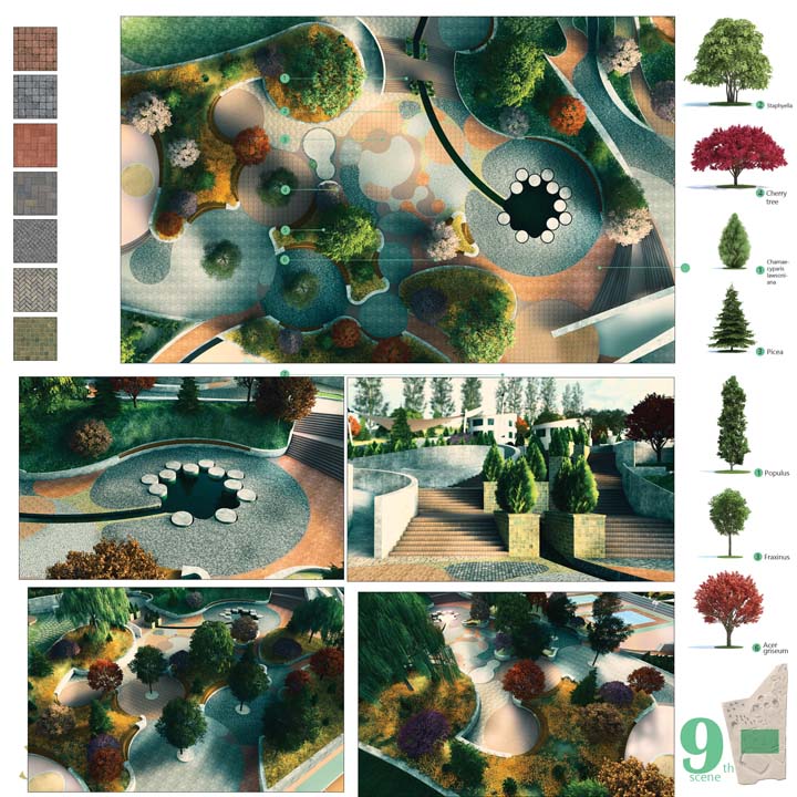
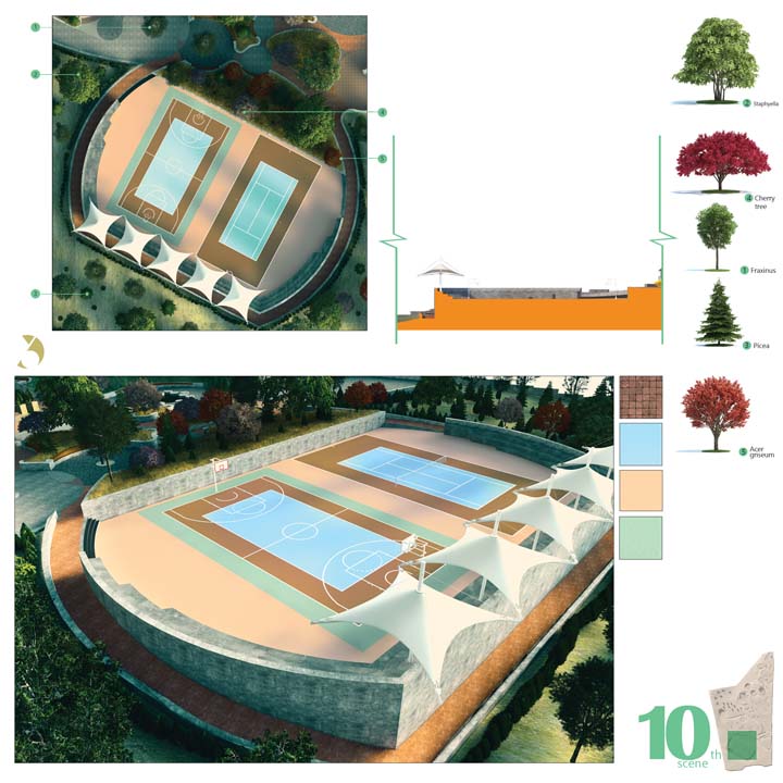
Scenes
Ecologically, the semi arid climate of Tehran was taken into consideration in selecting a diverse range of drought tolerant trees and plants suited to local conditions. In addition, the flooring materials are not treated only as decorative surfaces but as an active design tool for zoning. Different materials such as stone, wood, and gravel are used to define edges, guide movement, and structure outdoor spaces, contributing to both spatial clarity and experiential variation within the landscape.